
There are over fifty Welsh islands dotted around Wales’ coastline, from tidal islands you can reach on foot to remote rocky outcrops accessible by long boat trips, and from havens of marine and bird life to holy islands that have been the object of pilgrimages since the Middle Ages.
This is our guide to the best islands to visit in Wales, covering the entire length of the country’s coast, from the far north-west in the Irish Sea to the Bristol Channel in the south, starting in the north and working our way anti-clockwise around the coast. We’ll tell you what there is to see on each island, how to get there, when you can get there, and whether or not it’s possible to stay on the island.
So starting with the largest, here’s our ultimate guide to Welsh islands.
Contents
- 1 Anglesey
- 2
- 3 Puffin Island
- 4 The Skerries Anglesey
- 5 Holy Island
- 6 South Stack
- 7 Cribinau
- 8 Llanddwyn Island
- 9 Bardsey Island
- 10 St Tudwal’s Islands
- 11 Ynys Lochtyn
- 12 Cardigan Island
- 13 Strumble Head
- 14 Ramsey Island
- 15 Skomer Island
- 16 Skokholm
- 17 Grassholm
- 18 Thorne Island
- 19 Caldey Island
- 20 Worm’s Head, Rhossili
- 21 Mumbles Head
- 22 Sully Island
- 23 Flat Holm
Anglesey

The Isle of Anglesey – Ynys Mon in Welsh – has long been known as the Mother of Wales – Mam Cymru. At over 20 miles distance from east to west and north to south, it is far and away the biggest island in Wales, and the seventh largest in the whole of the UK. It is also one of the two islands on our list that you can drive onto in a standard two-wheel drive vehicle, or reach by train.
We’ll be publishing more in-depth features on Anglesey in the coming months, but this is a brief introduction.
Anglesey is mostly rural, with the exception of the port of Holyhead, North Wales’ gateway to Ireland. Much of the interior is given over to agriculture, gentle rolling green fields with distant views to the mountains of Snowdonia on the mainland. Anglesey’s 125 mile coastline has some of the best beaches and walks in Wales, indeed the UK, for that matter. It varies from the relatively sheltered Menai Strait, which separates the island from the mainland, to the sandy surf beaches on the west of the island, to the dramatic cliff walks of the far north coast.
Beyond the beaches and coast, there is a huge amount to see. Anglesey is rich in history, with a huge number of standing stones and burial chambers around the island. It was also home to many Druids until the arrival of the Romans in the 1st century AD. By far the best-known building from the medieval era on Anglesey is Beaumaris Castle, part of a UNESCO World Heritage Site along with the three mainland castles at Caernarfon, Conwy and Beaumaris.
The island is joined to the mainland by Thomas Telford’s early 19th century Menai Suspension Bridge, which links the small town of Menai Bridge to Bangor by road and footpath, and the Britannia Bridge, which is the less scenic but more practical route in for many, carrying the A55 North Wales Expressway and the railway to Holyhead.
Several of our other islands are located off the shores of Anglesey, including the following, Puffin Island.
Puffin Island

Puffin Island – also known as Priestholm, or Ynys Seiriol in Welsh is a small uninhabited island off the eastern tip of Anglesey.
Even in the 21st century its location feels quite remote. It sits a short distance offshore from Trwyn Du (also known as Penmon Point), which is accessible via a private road from the village and Priory at Penmon. At this exposed spot, there is an isolated row of cottages, a small pebbly beach, a black and white lighthouse and the view to Puffin Island and, beyond it the Great Orme headland which looms above the resort of Llandudno. It’s a very atmospheric place, with the sound of the sea and a warning bell tolling from a rock offshore.
Puffin Island was once home to St Seiriol, who lived there as a hermit in the 6th century. According to tradition, he would often meet with another future local saint, Cybi, who founded a monastery on Holy Island. They would meet somewhere on Anglesey, and because Seiriol had to travel there and back from the east, the sun was always at his back, so he was known as Seiriol Wyn, or Seiriol the Fair, while Cybi faced the sun both ways and was called Cybi Felyn, the Tanned.
There are scant remains of a 12th century monastery on the island, but the main reason for visiting is to see the seabird population. Despite its name, puffins are scarce there, having previously been wiped out by rats. There are hundreds of breeding pairs of kittiwakes, guillemots, razorbills and cormorants, to name a few. There is also a resident colony of Atlantic grey seals.
Most boat trips depart from nearby Beaumaris Pier, lasting around 90 minutes, and some also leave from Menai Bridge or Conwy area. The boats don’t usually land on Puffin Island as it’s a Site of Special Scientific Interest (SSSI). Visitors can only land in rare cases with permission from the landowner.
The Skerries Anglesey

The Skerries – Ynysoedd y Moelrhoniaid, the islands of the bare-headed grey seals in Welsh – are a series of remote uninhabited rocky islets off the north-western corner of the Anglesey coast, and they are the northernmost and north-westernmost place in Wales.
There has been a lighthouse on the site since the early 1700s, and it’s one of the most important in the Irish Sea. It has been automated since 1987.
As well as being home to the aforementioned seals, the islands are also home to a large seabird population, including Arctic terns, common terns, puffins and gulls.
The best way to visit the Skerries is by Ribride which run trips from Holyhead Marina, which also take in North Stack and South Stack on the north side of Holy Island.
Holy Island

Holy Island – Ynys Gybi in Welsh – is a large island off the north-west of Anglesey that is usually referred to as part of Anglesey. It is, and it isn’t. It’s part of the county of Anglesey, but has a distinct character of its own.
Ynys Gybi gets its Welsh name from St Cybi, the friend of St Seiriol who founded a monastery at what is now Holyhead, whose Welsh name is Caergybi, the Fort of Cybi. Holyhead is now a major industrial port with ferry connections to Ireland, so it’s always busy with traffic and people in transit. The church of St Cybi and the small Roman fort across the road from the ferry terminal are well worth a look, but it’s fair to say that most of Holy Island’s attractions are outside the town.
Holyhead Mountain is a fascinating place to explore for a couple of hours or so, especially the Roman remains of Caer y Twr (Fort of the Tower) at the top of the mountain and earlier remnants including the prehistoric hut circles near the road up to South Stack.
Holy Island’s coast is full of contrasts, from the sheer precipices at the Ellin’s Tower RSPB Reserve to the family-friendly beach at Trearddur Bay to the spectacular white sea arch of Bwa Gwyn, a short walk from the village of Rhoscolyn, in the south of the island. At one end of the village lies the White Eagle pub and restaurant which serves excellent food and, royal fans may be interested, was one of the Duke and Duchess of Cambridge’s haunts during their time living on Anglesey.
The island is easily reached by road and rail. The A5 and A55 take you into Holyhead, and a network of B- and minor roads take you to the places we’ve described. Stena Line ferries from Dublin also run every day (weather permitting) to Holyhead.
South Stack
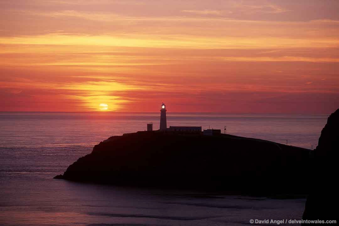
We’ve left one part of Holy Island out as it deserves its own mini-section – South Stack, which is home to one of the most dramatically-sited lighthouses in the country.
South Stack is actually an island – albeit a small one – known in Welsh as Ynys Lawd. It’s a long walk down from the summit of the cliffs above – around 400 steps – to South Stack lighthouse, which you can tour and climb.
It’s also worth making the short walk along the clifftops to the white castellated Ellin’s Tower, home to the RSPB South Stack Cliffs Reserve. Our most regular sightings there have been of choughs, distinctive black birds with curved red bills which are part of the crow family, but other seabirds including puffins, guillemots and razorbills also stop by in spring and early summer for nesting season.
Cribinau
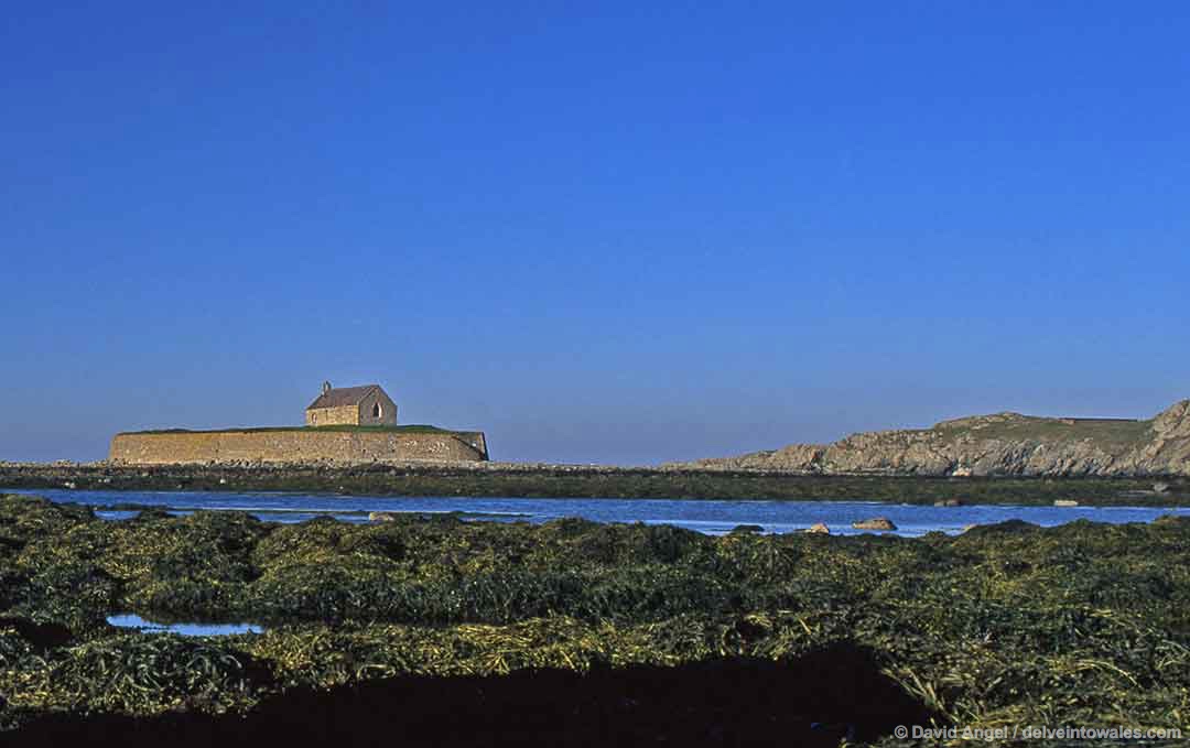
Cribinau is a small tidal island better known as the Church in the Sea, or Llangwyfan in Welsh, a short drive along a narrow lane from the coastal village of Aberffraw, in the south-west of Anglesey.
The sight that greets you at the end of the lane is one of the most evocative in Wales – across a curving rocky beach (Porth Cwyfan) lies a small church perched on a tiny, seemingly walled island.
The church dates from the 12th or 13th century, and is dedicated to the Irish saint Kevin. It was originally built near the end of a peninsula, which became an island as a result of coastal erosion. The church has been restored in the last decade or so, and the island walls were added in the late 19th century to keep the island intact.
You just need to check tide times before venturing to Porth Cwyfan and Cribinau island, which is sometimes cut off at high tide. Otherwise it’s a few minutes’ drive along Church Street and over the hill to the beach, which has limited parking, and a ten-minute walk from there to the island and church.
Llanddwyn Island
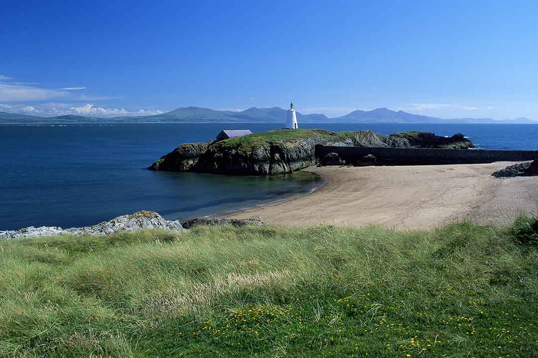
Llanddwyn Island is one of the most stunning coastal locations I have ever seen. Anywhere. And that’s after visiting over 40 countries and living on the east coast of Australia. There are very few places I have ever seen that begin to compare with Llanddwyn.
You approach Llanddwyn by turning left out of the village of Newborough, in the south-west corner of Anglesey, and pass through a pine forest, eventually paying for a parking ticket at a machine before proceeding to the car park, which lies just beyond the beach. Close to here, a wooden viewing platform has recently been built, and from here you can look along Newborough beach in both directions, and across Caernarfon Bay to the jagged outlines of the peaks of western Snowdonia and the Llŷn Peninsula.
Llanddwyn Island is a 25-minute walk from here along the beautiful shoreline: for much of the way, it looks like a long, low-lying line of rocks, giving little idea of what lies ahead. It is a tidal island, only inaccessible at very high tides.
The island is named after Santes Dwynwen, the Welsh patron saint of lovers. She lived in the 5th century AD, and her story is one of thwarted love. She fell in love with one man but her father wanted her to marry another. She prayed to be released from the unwanted relationship, only for the man she loved, Maelon, to be turned to ice. She then prayed that Maelon be thawed out and revived, that true lovers everywhere should be happy and that she should never again entertain thoughts of being married. One of the first things you see on the island is the ruined chapel dedicated to her.
A path continues through the dunes, eventually revealing incredible views with two lighthouses and beaches at the end of the island. This is simply one of the most amazing places I have ever visited.
Bardsey Island
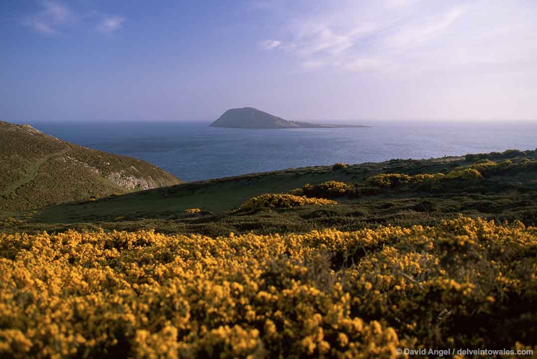
During the Middle Ages, this small island off the south-west tip of the Llŷn Peninsula was the object of many pilgrimages, and its importance was recognised as far away as Rome, where a Pope decreed that three pilgrimages to Bardsey would bring a soul the equivalent spiritual benefits of a single pilgrimage to Rome. Little did he know that, nearly 1,000 years later, Rome would be extremely easy to reach, and that getting to Bardsey is a journey that requires great persistence, enormous flexibility and an immense helping of luck to get there. I would go so far as to suggest that this decree should be amended, so that three pilgrimages to Rome are now worth one to Bardsey.
Bardsey – Ynys Enlli, the Island of the Currents in Welsh – is a four-mile (7 km) boat trip from Porth Meudwy, a cove near the village of Aberdaron. The often treacherous state of the waters of Bardsey Sound, which separates the island from the mainland, is what makes access – and sometimes getting off the island – so difficult.
Bardsey is also known as the Isle of 20,000 Saints. Its significance originates from the monastery that the Breton saint Cadfan founded there in the 6th century. It is also one of many places said to be the burial place of King Arthur. During its first few centuries of activity, the abbey became the resting place for many Welsh saints and holy figures, and this led to its growth as a pilgrimage destination. Ruins of the Abbey remain, and a prominent Celtic cross commemorates the 20,000 Saints.
Nowadays Bardsey is as well-known for its wildlife. Seabirds including the chough and the Manx shearwater have made it their home, and a colony of Atlantic grey seals also resides on the island. Its isolation has allowed other species and many rare plants to thrive.
We’ll be writing more about Bardsey Island in another feature to be published soon.
St Tudwal’s Islands
The horizon from the sheltered bay at the popular resort of Abersoch is dominated by two islands: St Tudwal’s Island East (Ynys Tudwal Fach) and St Tudwal’s Island West (Ynys Tudwal Fawr). They are named after a Breton monk and saint, Tudwal in Welsh or Tugdual in Breton, who was one of the seven founding saints of Brittany and later bishop of Treguier, in the north of the region.
Both islands are privately owned, so it’s not possible to land on them, but boat trips do run from Abersoch out around the islands to view the wildlife, which includes Atlantic grey seals.
Ynys Lochtyn

It’s a long journey across and down Cardigan Bay to our next island, the tiny Ynys Lochtyn, a mile or so north of the village of Llangrannog, on the Ceredigion coast.
We’ve included Ynys Lochtyn because you pass it on what we think is one of the best coastal walks in Wales, the steep, undulating walk north from Llangrannog, past hidden sandy coves and wind-lashed rocks. Ynys Lochtyn lies at the end of a dramatic peninsula with steep cliffs falling away to the sea on both sides. It is possible to reach Ynys Lochtyn on foot, with care, at low tide.
Ynys Lochtyn is also in prime Welsh dolphin-watching territory. Regular boats from New Quay Wales explore along the Cardigan Bay coastline, and sometimes travel down past Ynys Lochtyn and Llangrannog in search of these amazing creatures.
Cardigan Island
Cardigan Island – Ynys Aberteifi – is a small island barely 20 metres offshore, near the village of Gwbert, which looks across the Teifi estuary to Pembrokeshire. It’s a prominent ;landmark on this stretch of coast, and if you happen to be close to the lovely beach at Mwnt at the right time of year, it makes for a great sunset spot from the beach or headland.
Access to Cardigan Island is restricted – some chartered boats from Cardigan and Gwbert run to the island, and permission to land is required from the Wildlife Trust of South & West Wales.
The island is home to a flock of rare Soay sheep, a colony of Atlantic grey seals, and a variety of seabirds including gulls, puffins, razorbills and guillemots also stop by to nest there. The famous Cardigan Bay dolphins have been known to put in an appearance as well.
The headland close to the island is home to the Cardigan Island Coastal Farm Park, which has great views across to the island. It’s a great place to take the kids to meet the many farm animals, something that always enthrals our little fellow.
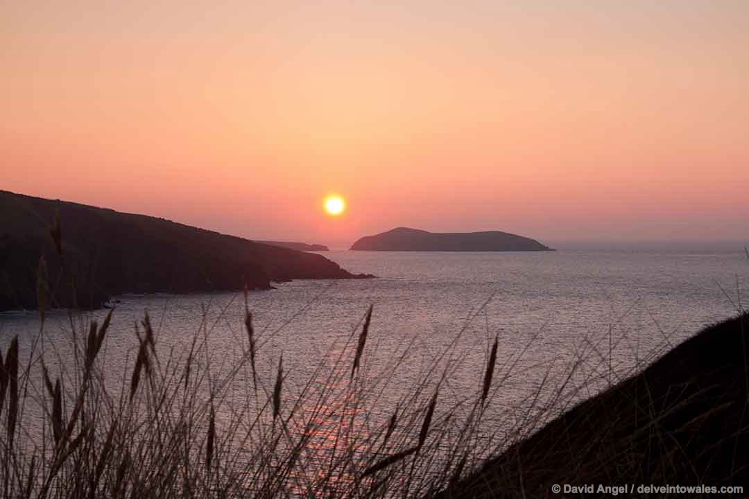
Strumble Head
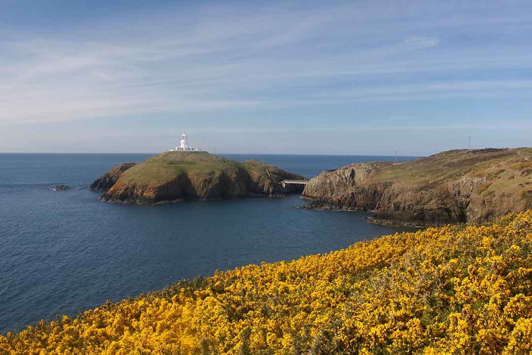
Strumble Head – Pen Caer – is a remote island and lighthouse warning shipping of the presence of dangerous cliffs and headlands on the approach to the nearby ferry port of Fishguard.
There isn’t any access to the island itself, as the lighthouse is fully automated, but that shouldn’t deter you from venturing to this stretch of coast, which has some of the most rewarding walking in the country. Strumble Head is a convenient place to park and explore, either southwards towards the magnificently-sited youth hostel at Pwll Deri and the Iron Age hillfort at Garn Fawr, or eastwards to Carregwastad Point, the site of the comically inept last attempted land invasion of Britain in 1797, when a French invading force (I’m not sure this is quite the correct word) were unceremoniously seen off by a combination of hastily-assembled reservists and ladies wielding pitchforks.
The old coast guard lookout near Strumble Head has been converted into a popular wildlife lookout, and because of the local geography with the peninsula protruding a few miles out into the sea many seabirds pass very close to the coastline. It’s also a great spot to spot the Cardigan Bay dolphins and harbour porpoises.
Strumble Head can be reached by several minor roads off the main A487 road that runs from St David’s to Fishguard and beyond, and in season by the wonderful Strumble Shuttle minibus that runs a convoluted but incredibly convenient service along the coastal backroads between Fishguard and St Davids three times a day each way in season, and twice a day on Thursdays and Saturdays in winter.
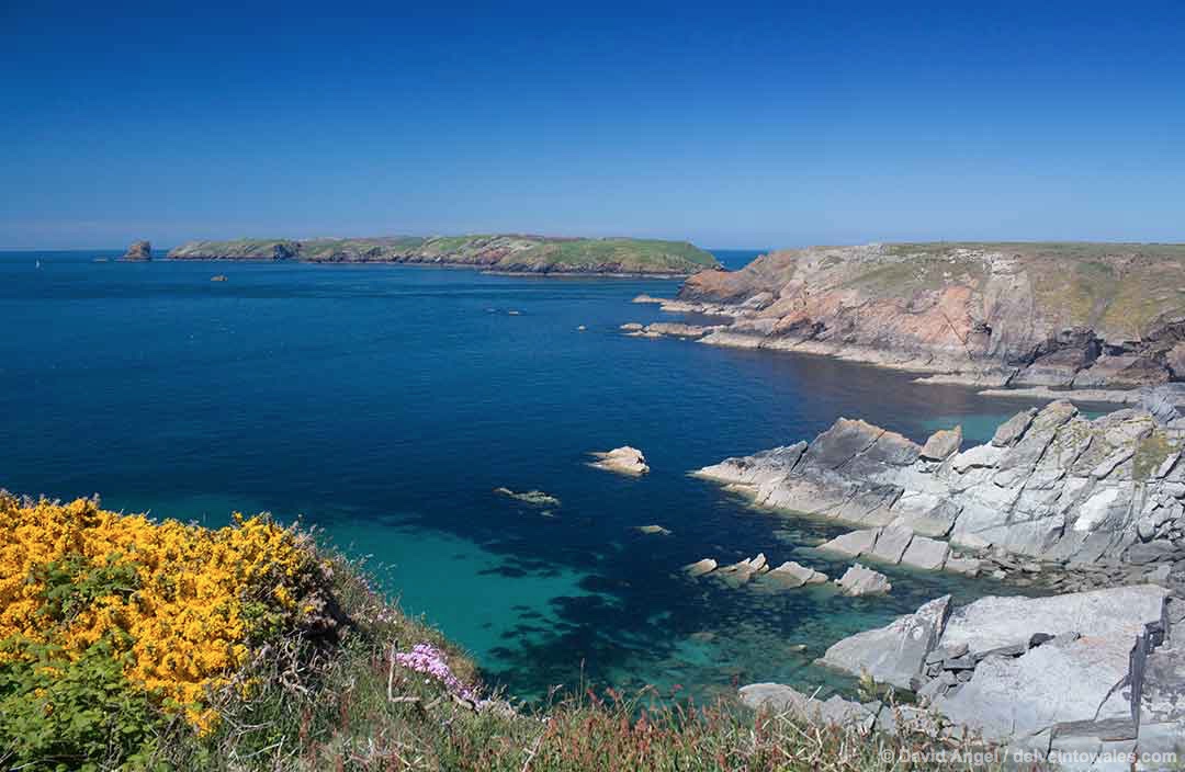
Ramsey Island
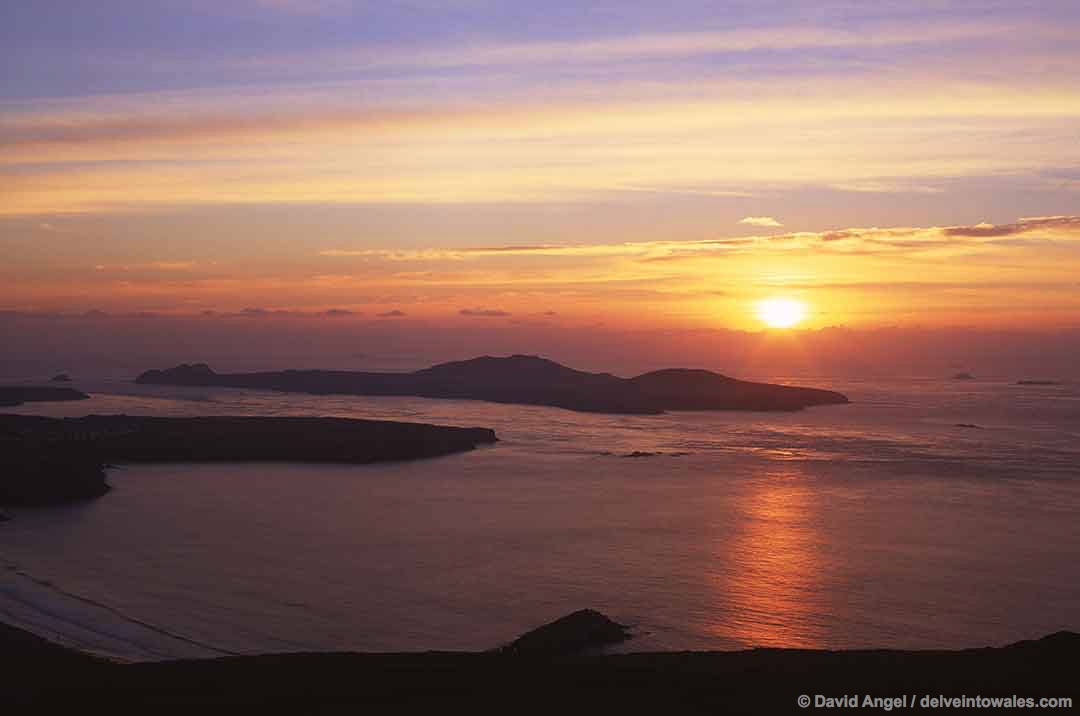
The St Davids peninsula is one of the most special places in Wales, and Ramsey Island, a short distance offshore, is one of the highlights of a visit to the area.
Ramsey Island – Ynys Dewi, or St David’s Island in Welsh – is a wonderfully romantic place, a short distance from St David’s Cathedral and surrounded by eccentrically-named islets called the Bishops and the Clerks.
It is reachable by boat trips that run from St Justinian’s, a gorgeous cove with old and new lifeboat stations. Some land on the island, while others circle it without landing, showing you the breathtaking coastline and magnificent wildlife. It is a nature reserve run by the Royal Society for the Protection of Birds (RSPB). There are also white water speedboat runs through the Bitches, a series of rocks in Ramsey Sound. The local boat operators are based in St David’s city centre, and include Thousand Islands Expeditions and Voyages of Discovery.
The wildlife you can see on or off Ramsey Island include grey seals, porpoises, choughs and gannets.
Skomer Island
Skomer is the largest island in Pembrokeshire and one of the most popular islands in Wales for wildlife enthusiasts. It’s not uncommon in the seabird nesting season of May to July to rock up to tiny Martin’s Haven before 7 am to find well over a hundred other vehicles have beaten you to it. Limited numbers of visitors are allowed each day, and demand undoubtedly outstrips supply on some days. Unfortunately there is no advance booking facility, you simply have to turn up very early and hope you’ve risen a bit earlier than your fellow visitors.
It is possible to book Skomer Island accommodation well in advance as one way to beat the queues, alternatively the best advice we can give is to look for accommodation near Skomer Island, possibly around the villages of Dale and Marloes, and to pack a fully-functioning alarm clock.
One of the reasons Skomer is so popular is that it’s such a great place to get close to and view seabirds. The iconic puffins can often be seen waddling along clifftop paths towards their burrows, their colourful beaks clutching their precious catch of sand eels. Kittiwakes, razorbills and guillemots are also a regular presence on Skomer. If you stay overnight on Skomer at the right time of year you should also get to hear and see the Manx shearwaters – with over 160,000 breeding pairs, Skomer is believed to be the largest breeding colony for this bird in the world. It is also home to a large Atlantic grey seal colony, and dolphins and porpoises are regularly sighted close to the island. It is also home to a unique subspecies of vole, the Skomer vole, which lives in outcrops of bracken on the island.
By a quirk of natural serendipity, the breeding season and the glorious spring flowers contrive to coincide, so in May and early June the island is carpeted with bluebells and red campion.
Skokholm

Skokholm Island (Ynys Sgogwm in Welsh) is a near-neighbour of Skomer, a few miles to the south and further offshore. It isn’t anywhere near as well-known as Skomer, partly because day-trippers can’t land on it, but you can stay on it, for three or four nights. Skokholm accommodation includes an 18th century farmhouse and some renovated former cow barns. Everything is off-grid, and solar power and bottled gas are the main energy sources on the island.
As with Skomer, the main draw for visitors is its wildlife. It was the first functioning bird observatory in the UK, founded in 1933, and there are plenty to see, including the Manx shearwater, puffin, guillemot and razorbill. There is also a storm petrel colony on the island, and visitors are privileged to accompany the wardens on their walks to weigh the gorgeous fluffy chicks. Seals, harbour porpoises and dolphins are also regularly sighted around the island.
Although there are no day visitors to the island, it is still possible to see Skokholm up close on boat trips. Dale Sailing, who run the Dale Princess boat from Martin’s Haven to Skomer, also operate a sea safari around the coasts of Skomer and Skokholm.
Grassholm

Grassholm Island – Ynys Gwales in Welsh – is the most isolated island in Wales, seven miles to the west of Skomer. Visiting it is also one of the most amazing experiences in Wales, and indeed the UK.
It’s not possible to land on this uninhabited island, but a number of operators run trips out to this remote outcrop of rock in the ocean. From afar, you see a distinct white speck on the horizon, which grows ever larger – and louder – as you approach. Sometimes you’re greeted by the cacophonous racket of around 80,000 gannets – the third largest colony in the world – squawking in surround sound. Thousands of birds fill the sky, some pivoting mid-air and dive-bombing vertically into the water with astounding precision to catch fish.
Some operators run a sunset trip out to Grassholm, when in the golden hour of low sunlight the experience becomes even more magical.
Thorne Island
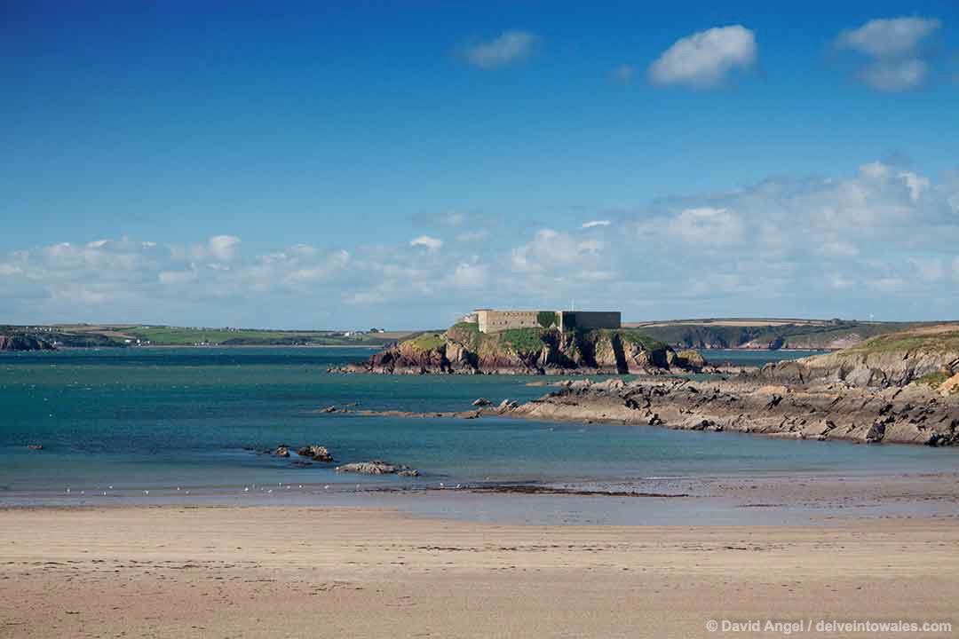
Thorne Island is one of a number of fortifications built to guard the Milford Haven waterway from the perceived danger of a French attack in the 19th century.
It’s an intriguing location, about half a mile offshore from the fine beach at West Angle Bay, on the south side of the Haven.
The Napoleonic fortifications are largely intact. It had been run as a hotel in the mid-20th century, but had been unoccupied since 2001. A hotel chain had bought the island with the intention of reopening the hotel and adding cable car access from the mainland, but this never came to fruition.
It has recently been bought again, and throughout 2017 has been undergoing restoration. It has recently been advertised on Airbnb and would make a fascinating place for an island adventure.
Caldey Island
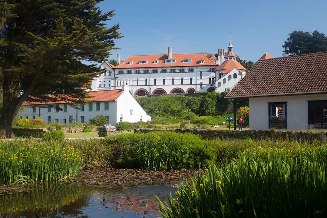
Caldey Island is one of the best-known islands in Wales, a popular day-trip destination from the nearby seaside town of Tenby.
Caldey – Ynys Bŷr in Welsh – is home to a small community of Cistercian monks who live in a striking white Italianate monastery a short walk from the landing jetty at Priory Bay beach. The island has a rich ecclesiastical heritage, with two much older churches – St Illtud’s and St David’s – close by. Access has recently been restored to parts of the island that had long been off-limits, including beautiful Sandtop Bay on the west of the island. A full day is needed to get around the whole of the island and visit the monastery.
The island is also well-known for its wondrous coastal scenery and its wildlife. In order to experience both the history and wildlife, you really need to take two boat trips – one landing on Caldey, and another circumnavigating the island and its immediate neighbour, St Margaret’s Island.
The monks on the island have been making a living for many years from making chocolates, perfumes and fragrances which are for sale at the island’s shop, which also sells online.
Worm’s Head, Rhossili
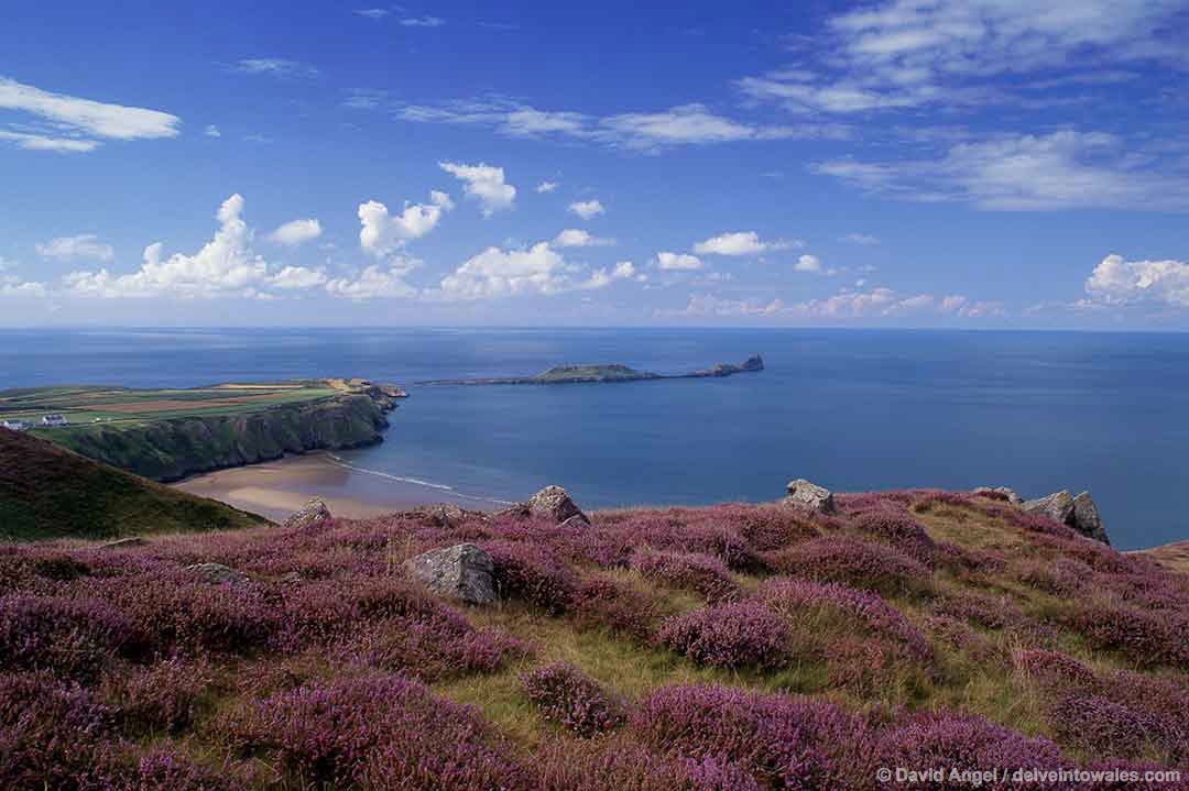
On a clear day you can see our next island, Worm’s Head, from Caldey, over twenty miles to the east on the western tip of the Gower Peninsula.
Worm’s Head – which is often written Worms Head without the apostrophe, is a long, narrow tidal island around 2 km from Rhossili Bay’s incredible beach. Rhossili has been in many a ‘top 10 in the world’ poll, from best beach to best place to view a sunset, and for now it’s best simply to let democracy speak for itself. When you look at Worm’s Head from the beach or up on the summit of Rhossili Down, it resembles a basking dragon, luxuriating in the sea.
Worm’s Head is accessible on foot two and a half hours either side of high tide. The easiest access is from Rhossili village – tide times are usually posted in the doorway of the National Trust shop – the footpath runs along the clifftops, giving some of the most awe-inspiring coastal views along the way, running out at a cottage with a small exhibition. From here it’s a short walk down the slope to the shoreline, and then you pick your way across the rocky tidal causeway to the island. A sunny day is best for this walk, simply because the rocks dry more quickly and are less slippery.
It’s a surprisingly long walk from one end of the Worm to the other. You can climb the small flat hill that is the middle section of the Worm, or walk along the bottom of it. After a rocky section, you gradually climb to the precarious-looking Devil’s Bridge before continuing past a spectacular blowhole to the Outer Head.
Many people have been stranded on Worm’s Head after being caught out by the rising tide, including the famous poet and writer Dylan Thomas, who was from nearby Swansea. So keep a close eye on the time and also allow for the causeway to be submerged faster than forecast.
Boat trips also run from Oxwich along the coast, including Worm’s Head, between April and September, and this is something not to be missed. On my last trip we encountered harbour porpoise, seals, and hundreds of swooping seabirds in the late evening light.
Mumbles Head
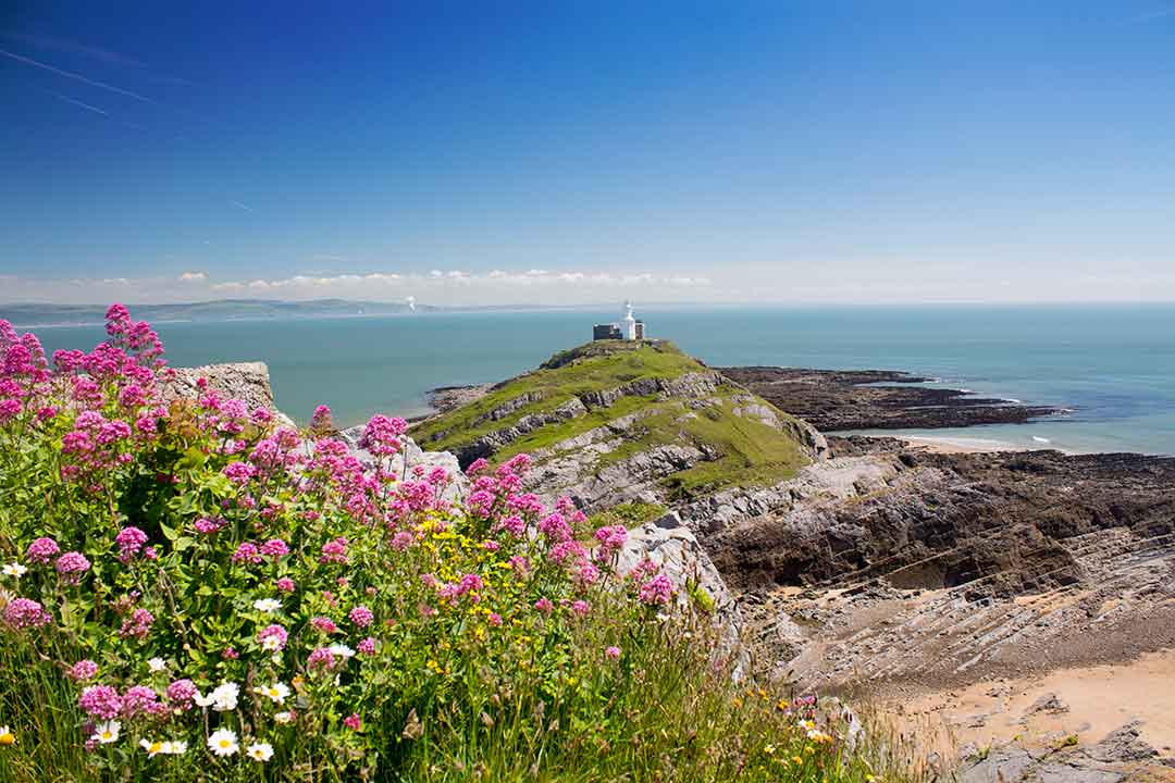
Mumbles Head and lighthouse lie at the opposite, eastern end of the Gower Peninsula, on a headland looking back along Gower one way, and across to the city of Swansea in the other direction.
Mumbles Swansea is one of South Wales’ favourite seaside spots, with a fine promenade, traditional pier and beaches either side of the headland. It owes its name to the French word, mamelles, meaning breasts, with which some French sailors may or may not have compared the two islands off the headland. Both islands are tidal, and the lighthouse island is accessible on foot at low tide.
Mumbles is easily reached by car or bus – the number 2 service stops in Mumbles village, leaving roughly a 1 km walk down to the pier.
Sully Island
Sully Island – Ynys Sili – is a tidal island near the village of Sully, which is close to the seaside town of Penarth in the Vale of Glamorgan.
The eastern Bristol Channel has the second highest tidal range in the world, and the wide rocky causeway connecting the island to the mainland can quickly disappear in a fast-rising tide. I personally know several people who have been stranded there, some overnight. A warning system now operates from the mainland, indicating when it is or isn’t safe to attempt to cross to the island.
It’s a very popular spot with locals, just seven miles from the capital Cardiff, and just a short walk from the Captain’s Wife pub in Sully.
It has a rich history of piracy, smuggling and shipwrecks, and was once the base of the notorious pirate Alfred de Marisco, who ransacked and pillaged all over the Bristol Channel.
There’s not a great deal to see on the island other than the coastal scenery, but if you’re in the area, it’s a great place to while away an hour or two before a little refreshment at the pub.
Flat Holm

Flat Holm island – Ynys Echni in Welsh – is one of two islands in the eastern Bristol Channel, between Cardiff and the English seaside town of Weston-super-Mare. It includes the southernmost point in Wales, while its neighbour to the south, Steep Holm (Ynys Rhonech) belongs to England.
Flat Holm is an intriguing place reachable by regular boat trips and cruises from Cardiff and Weston in season (usually April to October).
It has a long and rich history, and was home to the local saint Cadoc in the 6th century. The name ‘holm’ also indicates Viking association, or possibly occupation. During the 19th century a cholera hospital was built there, and the island was also armed with several gun batteries to protect the area from invasion. The most prominent building on the island is the lighthouse, which was built in 1737.
However, it is best known for being the place from which Italian inventor Guglielmo Marconi sent the first wireless signal across open water, to Lavernock Point on the mainland on 13th May 1897. The message ‘Are you ready’ was in Morse code, and the original paper slip can be seen in the National Museum of Wales in Cardiff.
When growing up in the area, Flat Holm was also well-known as the nesting site for many of Cardiff’s herring gull population, but there are actually far more lesser black-backed gulls on the island. Some rare plants, including rock sea-lavender and wild leek, also grow on the island, much of which is a designated Site of Special Scientific Interest (SSSI) and a Local Nature Reserve.
There’s one more reason to make the effort to visit Flat Holm – to enjoy a pint at the Gull and Leek, the southernmost pub in Wales.